Tuesday, June 20, 2017

On Wednesday June 14 went to Zion, including Kolob Canyon.


Bison ranch near east entrance to Zion NP.

 
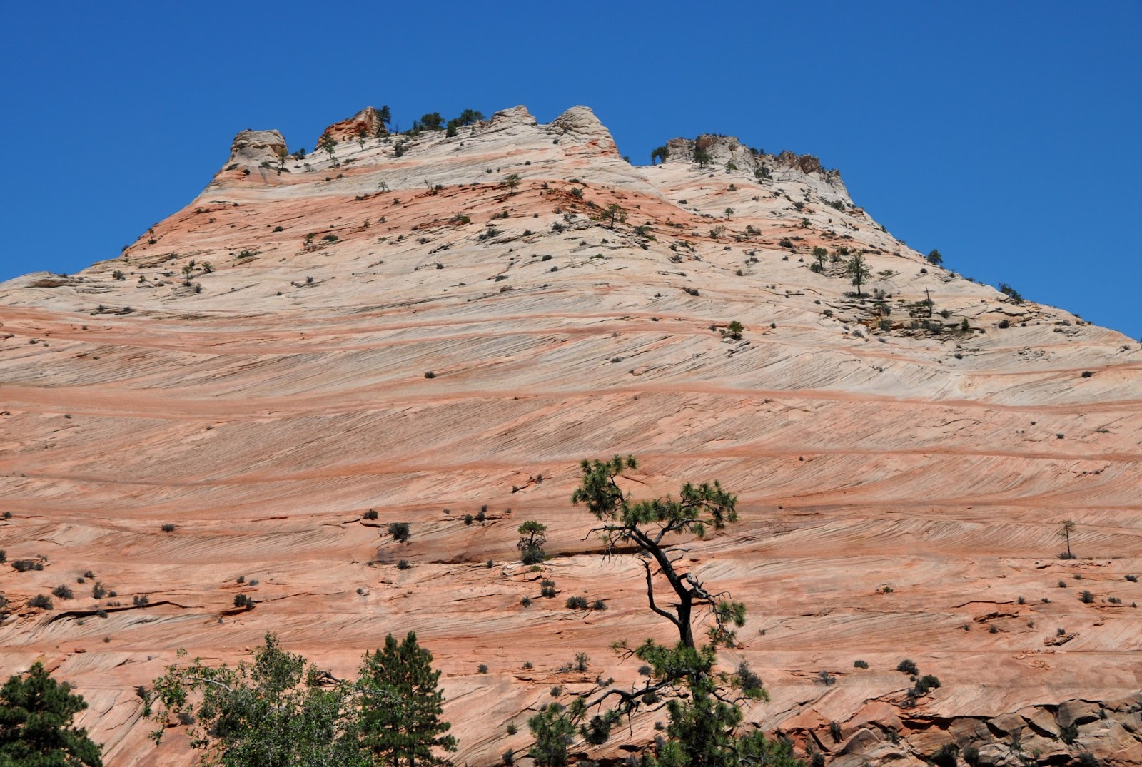
Checkerboard Mesa composed of Navajo Sandstone.

Cross-bedding in the Navajo Ss.

More cross-bedding.


Kolob Canyon

Basalt caprock on the Navajo Ss.

Desert bighorns in Zion.


Tuesday June 13 started with a short trip from Kanab to Coral Pink Sand Dunes State Park, followed by runs up to Cedar Breaks Nat'l Monument and Bryce Canyon NP to see the Tertiary Claron Formation.

Coral Pink Sand Dunes


Cedar Breaks hoodoos

More hoodoos looking west at Cedar Breaks.

Hoodoos in the Claron Fm. at Bryce.

Hoodoos near sunset at Bryce.

Claron Fm. at the edge of the Aquarius Plateau at sunset as
seen from Bryce.

Pronghorn antelope at Bryce.

Monday June 12 was and incredibly windy day for the drive from Moab to Kanab via Cedar Mesa, Muley Point and Monument Valley.

View from Muley Point at the southern end of Cedar Mesa.
Note the dust storm in Monument Valley in the background,

Monument Valley in a dust storm.

Sitting Hen Butte in Monument Valley.

Agathla Peak, a volcanic "neck" in Monument Valley.


On Sunday June 11 went to Mill Canyon Dinosaur Trail and then for some short hikes around Arches because the heat and the sun and the crowds were brutal.

Sauropod vertebrae at Mill Canyon

Double Arch

Erosional "fins" in the Entrada Sandstone

Broken Arch

Fiery Furnace in the foreground with the La Sal Mtns. in the background.

Sunday, June 11, 2017

Traveled down Kane Creek Rd. along the Colorado River from Moab to see the Triassic section there.
Triassic section along Kane Creek Rd. The uppermost cliff-forming layer is the Wingate Sandstone, below is the Chinle Formation with the gray-green layers, and the underlying Moenkopi Fm. can be seen in the lower left.

Erosional "fins" developing in Navajo Sandstone.
Fisher Towers along Rt. 128 east of Moab, Fisher Towers composed of  Permian Cutler arkose capped by Triassic Moenkopi Fm.


Cutler arkose from Fisher Towers.

Mesa Arch at Island in the Sky.  https://www.earthmagazine.org/article/mesa-archs-hum-measured-track-health-rock-structure


Saturday, June 10, 2017

Crossed Rocky Mountain NP today and then traveled to Moab.

The Boulder Flatirons from Rt. 36

Longs Peak

The Never Summer Mountains

Friday, June 9, 2017

Second day of travel, reached Denver area just before sunset.  Too much driving, not enough photo taking.  Will have some tomorrow.

Sunday, July 19, 2015

Sedona and Oak Creek Canyon

These are photos from the last two days taken around Sedona and Oak Creek Canyon.  This is looking along the Oak Creek Canyon fault.  The left side is the downthrown block, and the right side is the upthrown block.


 These photos are from hiking around the Brins Mesa Trail.


This is from the airport road overlooking Sedona.


Tomorrow I head for home, so this will probably be my last post for a while.  Its been a wonderful two weeks on the road!

Friday, July 17, 2015

Lake Mead

On the way to Sedona I stopped at Lake Mead and Hoover Dam.  The water level at Lake Mead is tangible evidence of the effect of the 15-year drought on water resources in the southwest.  The terraced benches in this photo show the shoreline elevations of Lake Mead at different times.  At one time, all of this was underwater!


Here is a shot of the same area showing the current water level.  The terraces from the previous photo are in the right background.


This image shows the "bathtub ring" around Lake Mead that marks the high water level from 1983.  The water is about 158 feet below that now.


In this image, where the pavement ends is pretty much where the marina used to be during times of higher water levels.  The marina has had to be moved about 1000 feet to keep up with the retreating shoreline.


Here is another photo of the "bathtub ring" right at Hoover Dam.


Hoover Dam is still an impressive structure!!!  It's 726 feet from base to crest.


These are the 8 generators in the powerhouse on the Nevada side.  The combined power of the 17 generators from both sides is about 3 million horsepower.  The rated capacity of the powerplant is 2080 megawatts.

This is a photo of one of the four water intake towers that send water flow through the dam to the powerhouse.  When the lake is full, the water level is just below the concrete walkway that connects the intakes with the main dam structure.


Arrived in Sedona AZ just in time to catch the setting sun lighting up the rocks!


Thursday, July 16, 2015

Death Valley

Today's trip was to Death Valley.


At Dante's View, more than 5500 feet above the valley floor, you can really see Death Valley as the ultimate expression of Basin and Range topography.


This shot is from Dante's View looking down at Badwater, at 282 feet, the lowest point in North America.


These are the highly eroded lake sediments at Zabriskie Point


When I was at Badwater, the high for the day a few miles up the road at Furnace Creek was 113 degrees.


Out on the salt flat.


Tomorrow its off to Hoover Dam and Sedona AZ.